Using a birding misidentification as a metaphor, this piece argues that avoided conversion carbon credits are only as credible as their baselines — and that opaque "black box" reference area selection puts buyers, developers, and the market at risk.
See an ExamplePart 2 of 5 | Previously: Certain Loss
Reading time: ~5 minutes
When COVID rolled around, I had been birdwatching for about 2 years. Even with the latest technology of eBird and Merlin and a pair of Vortex binoculars, I was just an ambitious amateur. With nowhere to go during the pandemic, I sought out nooks and crannies around southern New England where the next "Life List" bird might be passing through – poking around from the fields of Northampton to the swamps of Bridgewater and the dunes of the Outer Cape.
One day, my brother, Greg, texted me about visiting in the fall. I hooked him on this cuckoo hobby the year before. Typically a stormscape photographer, he now pointed his lens at migrating warblers and diving ducks. He proposed a trip near the Canadian border, and a late night of laptop research unearthed an article from Bird Observer on the best locations for boreal species in the Northeast Kingdom: Birding Essex County, Vermont. Autumn was an ideal time, plus we had a good chance to see irrupting crossbills and grosbeaks.
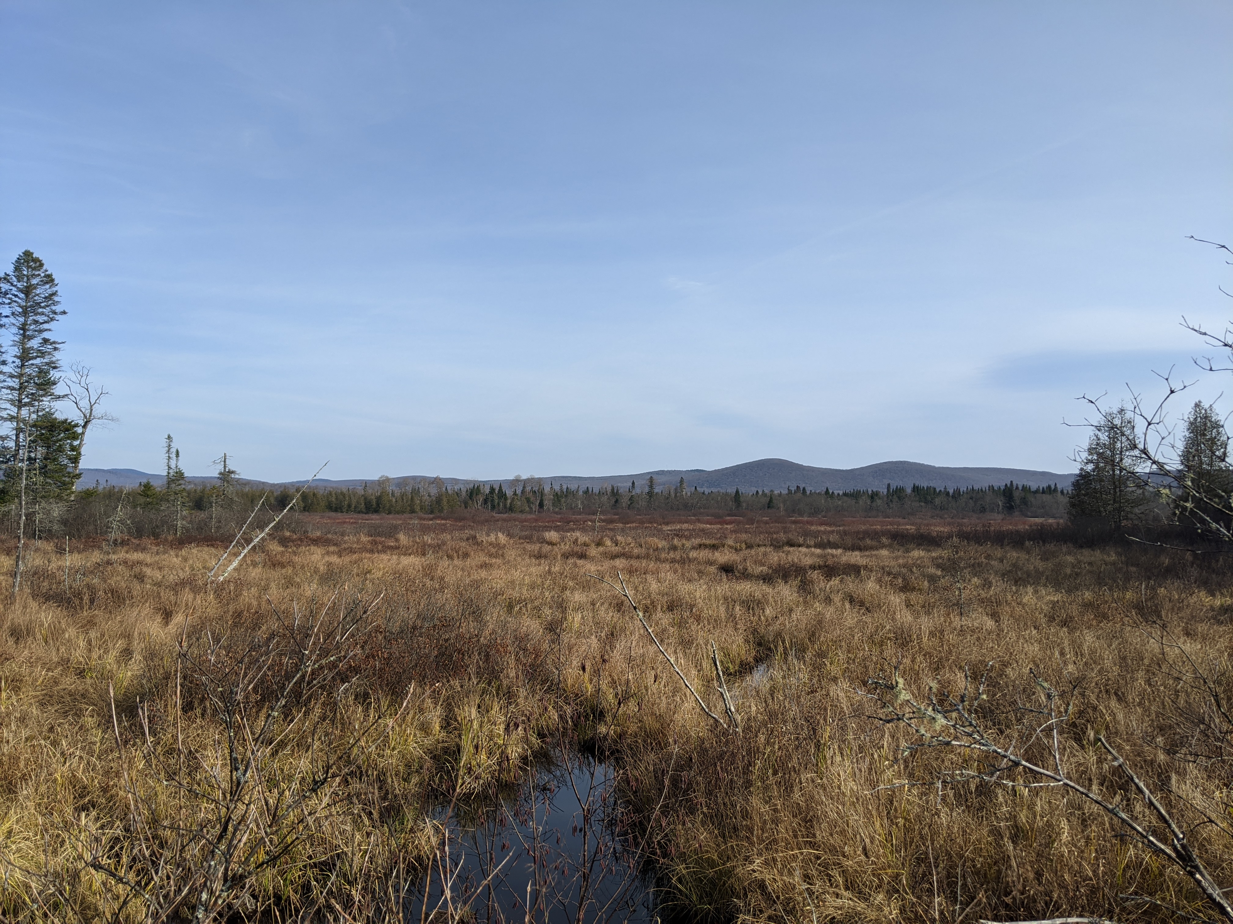
Come November, we had excellent weather for northern Vermont: Freezing at dawn and warming to near 50 F by the late afternoon. The last of our stops was the Damon Crossing trailhead at a culvert bridge spanning Bog Brook, a headwater of the Moose River in Victory Basin. Our trail formed a short out-and-back route along an ancient logging railbed surrounded by black spruce, and across the bog lay the mountains forming the basin’s rim. Beavers took advantage of the railbed for their own hydrologic projects, so we were happy about our waterproof boots as the trail became wet and overgrown. The few leaves left on the trees and bushes were rusty brown, and the sun sat low in the clear afternoon sky.
Our route led into a deep, damp spruce forest. Tiptoeing along the mossy ground and listening for any sound, we were startled by a faint clatter of wings. A dark chicken-sized bird flushed from the low branches above our head. The habitat was right, and the behavior and perch - in the spruce branches - seemed correct. With confidence from the article’s guidelines, I pulled out my phone and reported 1 Spruce Grouse on my eBird app. I jotted down a brief description of the behavior and location to address an automated caution that the bird was rare. We returned to the car, catching good looks and pictures of a cooperative Black-backed Woodpecker working a dead tree in the bog, and drove off, celebrating our finds. Greg and I still reminisce about that trip today.
Last year, an email hit my inbox from an eBird Reviewer: Your 2020 Spruce Grouse Sighting. eBird Reviewers are responsible for data integrity in the citizen science app loved by thousands of birders. The reviewer asked me to provide more field notes to justify the identification – it was unusual for the region. I typed a quick response with my original field notes and a more precise location, and justified the report based on the 2015 Bird Observer article by Tom Berriman highlighting Spruce Grouse in the area. The reviewer responded, beginning his email with, “Hi Matt, I am Tom Berriman.” Tom taught me that spruce grouse had not been credibly seen in Victory since 2016 – one year after his article and 4 years before our visit. A reintroduction campaign in 2010 and 2011 seemed to have failed. Any verifiable sighting would be of great interest to Vermont Fish and Wildlife.
Had I known! Greg and I would have been hunting for a verifiable Spruce Grouse like it was an Ivory-billed Woodpecker. After 5 years I could not recall any unbiased details about the sighting – now a myth in my memory – and my 2020 data entry had unhelpful variables. I could not prove the bird was a Spruce Grouse, so I removed the report and my Life List dropped by 1. Now, I document the hell out of any rare sightings, lingering when I find one to record a back-up recording of a call, detailing the field markings and behavior, or even pulling a quick picture with my phone through my binoculars. And when I can’t prove a rarity with verifiable data, I don’t claim a sighting.
Viable Avoided Conversion carbon projects in the United States, like Spruce Grouse, are rare. Any site selected for either an Avoided Conversion project or the dynamic baseline must provide compelling proof of that site’s loss risk. The data backing identification of a baseline site should be accessible in a way that allows a different analyst to identify the same baseline sites as documented in the claim. And in a way that the project proponents can use to defend the reference area in the future. As stated by the ratings firm, Calyx: The biggest problem with forest protection projects is the baseline.
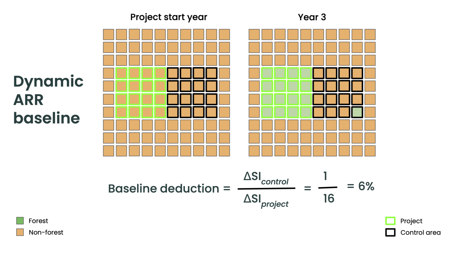
To compare apples to apples - or Spruce Grouse to Spruce Grouse – in carbon projects then we need evidence of deforestation risk in both the project areas AND the reference sites. An organization claiming additionality (or lack thereof) without verifiable transparency into their reference area sampling (dynamic baseline, pixel-matching, or otherwise) may have outdated data or biased conclusions.
Let's use an example:
Project Area: Exurban forest 60 miles from major urban center
Sampling criteria: Assume you are sampling reference areas for the baseline in the same watershed, and all sites have similar:
Those are the criteria that Pachama used to identify reference areas.
Suppose you have two sites to choose from, each with nearly identical measurements: Site A and Site B, both approximately 60 miles as the bird flies from the same urban center. How do you identify the reference area for a carbon project?
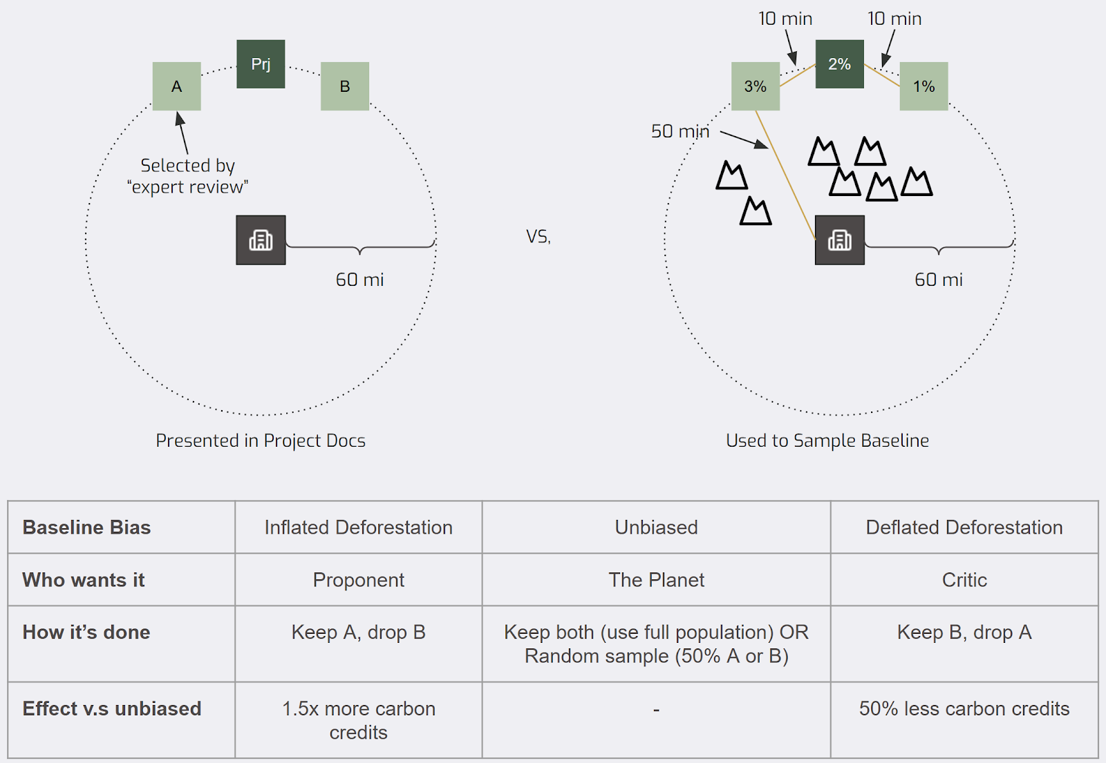
If site identification (human or algorithmic) uses travel time without disclosing it as a selection variable, the user can systematically manipulate the risk profile of the reference areas while still following a methodology. Honest mistakes can be made, too: The reference area model may simply lack critical features that predict future deforestation risk.
Black Box Baselines allow room for manipulation and create future risk for buyers, third-party reviewers, and project developers. Each flawed reference area today - just like a flawed project area - risks a painful accounting correction years from now.
Next in Part 3: “Carbon Removals” Mania